Il monte Bavarione, la dolce montagna
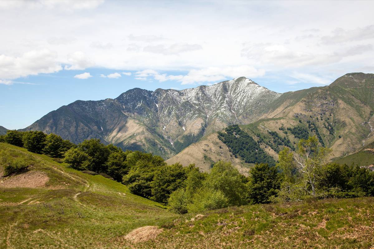
Monte Bavarione is the smoothest mountain among the ones characterizing the head of the Valley Intrasca.
The proximity with Monte Zeda, the Queen of the Lake, gives it the alpine features, leaving to Monte Bavarione the smoothness of its ridges and deep green pastures.
The panorama that can be admired from the top is of a touching smoothness: The Swiss Alps, the Cannobina Valley and Lake Maggiore are filtered through the beech woods that goes up from the North, up almost to the top, mixing with pastures and blueberry bushes following the winding trails of the military trenches of the Cadorna Line (Linea Cadorna): this is a “Slow Panorama”!
Beschreibung des Reisewegs
From Colle drive down the military trail of the Cadorna Line, recently renovated, up to Pian d'Arla and then to Pianpuzzo.
You can leave your car in this place and climb along the eastern ridge of monte Bavarione.
At the top the itinerary is absolutely free, through the pasture and the beech woods, playing with the trenches, covered by blueberry bushes and rhododendrons.
The descent along the military trail of entrenchment is full of surprises: the cannons positions, the small caves, the mighty retaining walls, all to be discovered quietly.
Arriving in Passo Folungo, and the necessary stop at the fountain, you definitely change direction along the way of the flat military trail for the return, recently renovated, with gratings in shaped stone and lateral gutter, an admirable work.
The way back is along the road, passing high above the green meadows and pastures of Bavarone, Scogno, Biogna and Crestalunga, shortly arriving then in Pianpuzzo.
Nützliche Informationen
This is an itinerary SLOW PANORAMA.
Geeignet für
Erwachsene
Kinder
Eigenarten
Technische Probleme
Tief
Körperliche Schwierigkeit
Tief
Typologie
Zirkular
Laufzeit
1h 45m
Länge
4,3km
Gesamter Höhenunterschied der Anstieg
232m
Höchstantteil
1505m
Günstige Zeit
mai
juni
juli
august
september
oktober